For Canada Day, let’s have a quick look at one of Canada’s most popular science centers: Science North.
Even though I spent seven years in Toronto, I never managed to make it up North, to Sudbury. This mining town in Ontario was established when railroad workers discovered nickel ore during railway construction. The town’s nickel mining heritage is highlighted in one of its tourist attractions, the Big Nickel.
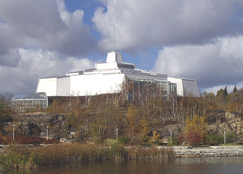
A much bigger attraction in Sudbury, though, is Science North. It follows the common formula for big science centers, with various exhibits, evening entertainment, and an IMAX theatre, but, true to its name, Science North does offer some unique exhibits specific to the science and technology of Northern Ontario, including exhibits on local wildlife and the local underground physics lab SNOLAB. They also co-run a science communication degree with Laurentian University.
Science North is one of the science centers I’ve heard only good things about from people who either visited it or worked with them, and if I’m ever in Ontario again with some time to spare for a trip up North, I will visit!
Walked the sand with the crustaceans,
Could find my way to Mariana
– The Pixies
Walsh and Piccard in their sub, on the way to Mariana.
Have you ever been to the Mariana Trench? If you have, you are either oceanographer Don Walsh or film director James Cameron, because the only other person to ever have visited the trench (Jacques Piccard) died in 2008. Hello Don or James! Thanks for reading The Finch and Pea.
If you’re one of the seven billion other people who haven’t yet visited, here’s a bit of travel info: The Mariana Trench is the deepest part of any of the oceans on Earth. It’s located in the Pacific Ocean, between Japan and Papua New Guinea. The trench forms the boundary between two tectonic plates: the Pacific plate in the East and the small Mariana plate in the West. The Mariana plate pushed over the Pacific plate, which created the trench at the border. Above the surface, the tectonic plate boundary forms a series of small islands, the Mariana Islands. The island of Guam, just South of the Mariana Islands, is also part of this system. Continue reading “Finding their way to Mariana”
While several countries have sent sports teams to Brazil, one country has sent something much more important. The massive Amazon River, providing life to the rainforest that houses a third of all species in the world, originates from a small glacial stream in Peru.
The Amazon meanders through Brazil all the way from its western borders to the Atlantic ocean in the east. Along the way, it picks up streams from all over the northern half of South America, but by definition the origin of a river is the source that is furthest away from the end of the stream. For the Amazon, that source is found on a mountain in the Peruvian Andes, called Nevado (snowy) Mismi.
Mismi was first identified as the origin of the Amazon by Loren McIntyre in 1971. Jacques Cousteau’s 1982 Amazon Expedition also led to Mismi as source. Other expeditions confirmed this in 1996, 2001, and 2007. So, we’re pretty sure that this insignificant-looking pond in the Andes is the furthest source of the largest river in the world.
According to Wikipedia, the site is only marked by a small wooden cross (see photo above), but when Ed Stafford set out to walk the full length of the Amazon from source to sea in 2008, he discovered that this was not entirely true:
“Within minutes we could see the cross and scrambled up the rocks to get to it. On our way we found a plaque announcing we were at the source. We ignored it and pushed on as “Wiki” can’t be wrong.
When we arrived at the source it was as we imagined: a steady spring of water coming out of the cliff above us and a nice white wooden cross. We took lots of photos but as we were about to leave we saw, twenty meters below, an iron cross. On inspecting, this cross had been erected by another expedition, this time in 1971.”
There is no single source at Mismi. Glacial streams emerge from the rocks at various places at different times. Stafford continues:
“Four completely separate teams have given four different locations as the source. The mountain is glaciated and covered in snow, there are water bodies and sub-glacial streams galore above all four “sources”.
So we decided to stop playing the silly “which source is the true source?” game and decided that we were happy that we had summitted the mountain on which the furthest tributary of the Amazon springs, and we were on our way to walking the length of the Amazon.”
Eva is off today, which gave me a chance to get update the Have Science Will Travel Map. While Eva has done a wonderful job highlighting the writing of others about science-y destinations, I have done a miserable job of adding the destinations she has been writing about here at The Finch & Pea. Let’s blame it on the end of the school year chaos and my kids, like usual.
One of the biggest treats for me was getting to add the Baikonur Cosmodrome in Kazakhstan as a location for Eva’s “Dark Side of the Moon” post. The Baikonur Cosmodrome was the launch site for Luna 3 in 1959, which was the first probe to actually take images of the far side of the moon (ie, never visible from earth due to tidal locking).
2014 Manhattanhenge. Photo by Jeffrey Putman on Flickr.
This past week was “Manhattanhenge” in New York City. This event occurs twice per year, on both sides of summer solstice, when the setting sun aligns exactly with the street grid.
The name is derived from Stonehenge, which shows a similar phenomenon exactly on solstice. While Stonehenge is believed to have been built specifically with this light effect in mind, Manhattanhenge is just an artefact of the street grid of Manhattan.

 For Canada Day, let’s have a quick look at one of Canada’s most popular science centers: Science North.
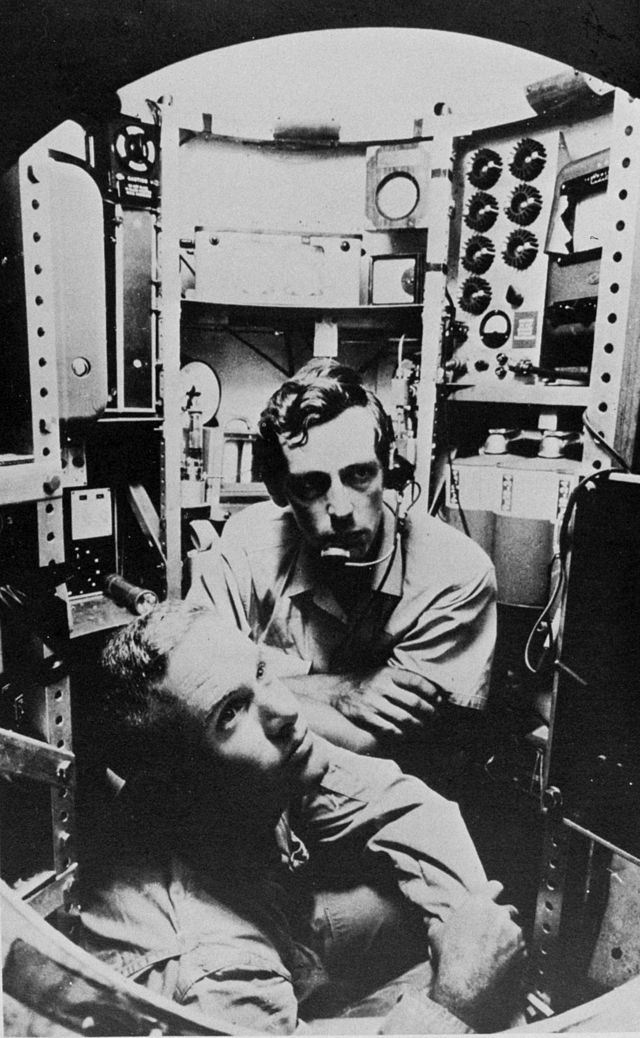


