The zero meridian, or something like it

CIMG1443
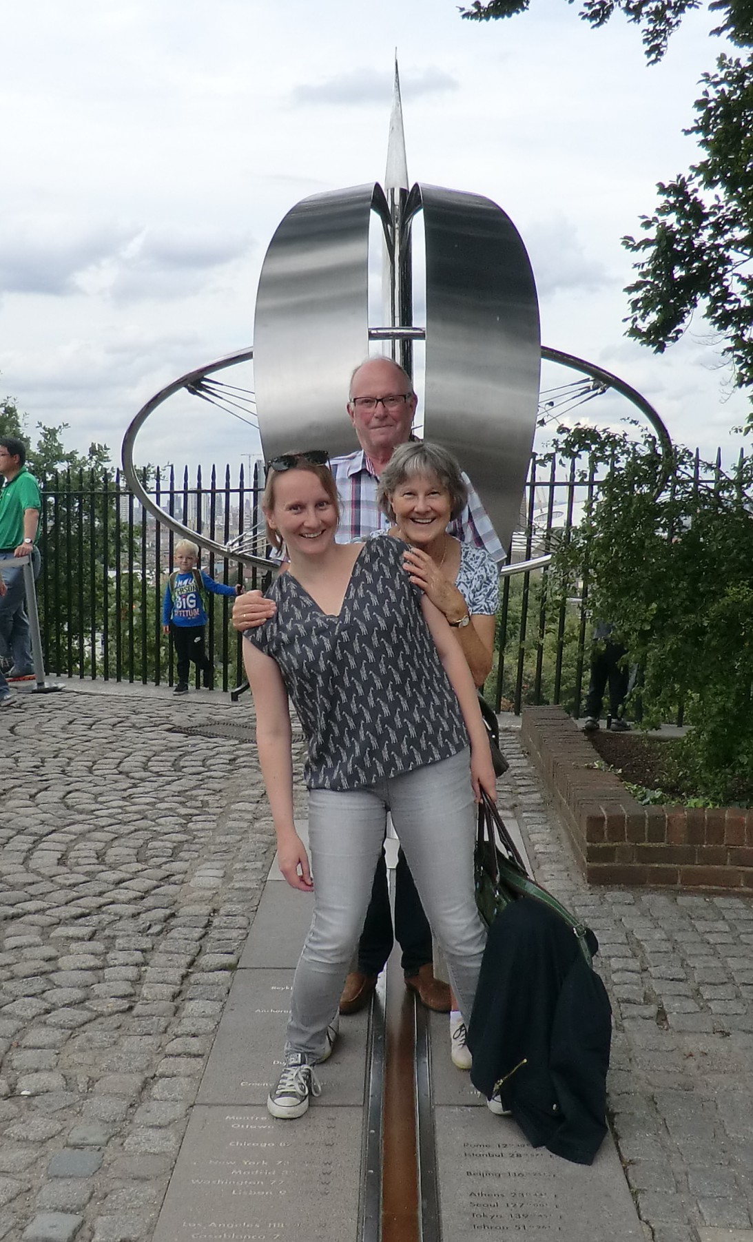
This weekend I took my parents to visit the Greenwich Meridian – or did I?

The marked meridian on the site of Greenwich Observatory, where tourists line up to pose for silly pictures with one foot in the East and one foot in the West, has claimed to be zero degrees longtidude since 1884, but if you check your smart phone GPS on that spot, you’re NOT at exactly 0.000 degrees.

According to GPS, the zero meridian appears to be in a park adjacent to the observatory, and not in the section behind the fence that charges admission so you can “visit the meridian”.

2015-08-29 14.06.58

What’s going on here?

Earlier this month, an article by Stephen Malys and others in the Journal of Geodesy revealed the reason behind the discrepancy. The technology used in the 19th century to determine the location of the zero meridian was subject to local distortions from the Earth’s gravity and shape of the local terrain. GPS technology uses measurements from satellites, which aren’t affected in the same way as technology located on Earth.

Screen Shot 2015-08-31 at 21.00.00
The dotted line is the much photographed meridian established in 1884. The solid line is where the GPS says it should be.

So the meridian really is in the wrong place. What does that mean for maps or for time? Well, the Ordnance Maps used in the UK were already using a slightly different zero meridian as reference point, because they were established before the 1884 meridian convention. And the effect of the new meridian location on Greenwich Mean Time, which determines Universal Time, is unnoticably small, so nothing much has changed.

Except, for a shorter line and a cheaper visit, you could technically skip the museum and the crowd of tourists and find the true GPS meridian about a hundred meters to the East of the Observatory in Greenwich Park. It’s probably not as fun a place for a family visit, though.

Aerial photo is Figure 1 from the article by Malys et al. (CC-BY). Photos taken from the ground are by me and by the man who was behind us in line at the almost-but-not-quite meridian line. I previously wrote about the history of the Greenwich Observatory on this site.

The Chevin

I visited the area around Leeds recently, and came across this sign [pdf] by the Leeds Geological Association, on the Chevin.

IMG_0167

The Chevin is a ridge in the West Yorkshire landscape, formed over thousands of years. The surrounding area is mostly a valley (one of the “dales” of the Yorkshire Dales) formed by prehistoric rivers and glaciers.

IMG_0163
The view

I wasn’t expecting to encounter any science on this trip, so the geology sign was a surprise. Fittingly, I found it at “Surprise View”, the highest point of the Chevin.

Black Rock Observatory

Unlike most observatories, Black Rock Observatory has no fixed location. It’s not permanently fixed on top of a hill or on an island. Instead, it is about to make its way from Los Angeles to the Nevada desert, where it will be installed for the Burning Man festival that starts at the end of this month. In September, it will all be packed up again and removed.

brobs

Black Rock City, the location of Burning Man, is a place that only exists for one week every year. It runs entirely on a sharing economy, and it’s out of range of mobile phone providers and internet. For the entire week, the participants of Burning Man are part of a community with no ties to the outside world.

BlackRockObservatoryIt’s the perfect place to look up at the stars together, so last year a group of scientists, artists and engineers created the first Black Rock Observatory. The domes, designed by Gregg Fleishman, are relatively easy to transport and the creators have since visited several other events with the mobile observatory, bringing astronomy to an even wider audience. Besides looking through the telescopes, visitors can hold a meteor, and learn more about space.

This year Black Rock Observatory will be back at Burning Man with a second telescope, to give even more people a chance to visit the impromptu observatory.

telescopeThe theme of Burning Man this year is “Carnival of Mirrors”, which is a very fitting theme! As the creators, the “Desert Wizards of Mars”, said on their (successfully funded) Kickstarter page: “There will be a lot of mirrors at Burning Man this year, but our very special mirror will show you wonders that are light years away in perfect focus from the comfort of our Macro Dome. (…) Our telescope’s precision, hand-crafted, parabolic mirror cradles light to allow you to see through space and time. It has a silicon dioxide coating and will transmit millions of travel-wary photons into your pupils every minute.”

All images from the Black Rock Observatory website. Many more on there!

Art + Travel + Science on the DNA Trail

On a rainy day in London, Eva and friends went on a quest to find the DNA sculptures scattered around the city by Cancer Research UK.

El Dorado – The mythical city at the lake

El Dorado, the city of gold, was a popular legend in the 16th century. At that time, large parts of South America remained undiscovered, so who knew what secrets the continent held?

According to legend, El Dorado was located at Lake Parime. Sir Walter Raleigh was the first explorer to try to find the lake, in 1595. He didn’t find it, but that was no reason to believe it wasn’t there. Maybe they just hadn’t looked closely enough?

Lake Parime, a location marker for the city of El Dorado. At least one of these things is a myth.

Several other expeditions set out in the direction of the supposed lake, but nobody was successful. Of course not. The lake, like the city of El Dorado itself, was just a myth.

Or was it?

According to our modern day oracle of Wikipedia, there is some geological evidence that suggests that there were indeed lakes in the past in the area where Lake Parime was thought to be, and that some those lakes could have carried gold that came from mountains upstream, leading to myths of an entire city of gold. Some researchers believe that the painted rock of Pedra Pintada was alongside an ancient lake. Others have found evidence that a 17th century earthquake drained an entire lake that could have been Lake Parime. But the one research paper cited on Wikipedia as reference to suggest that Lake Parime might have been the lake drained in a 1690 earthquake does not make this assumption at all.

Was there really a city of gold, or even a mysteriously vanished lake?

Citation needed.


Map: 1656 Sanson Map of Guiana, Venezuela, and El Dorado . Public domain. Via Wikimedia.

%d bloggers like this: